Everybody Staze...

Nobody leavz...

  • Home
  • About Me
    • LinkedIn
    • Lab
  • Contact
  • Links
  • Reviews
  • Sitemap
  • Weather
You are here: Home / Archives for GPS

Raspberry Pi B+

2014/11/17 By staze

B_Pi_1_of_4_1024x1024After trying to control multimeters, programmable loads, power supply, etc, I decided I really needed some device to “run” my bench. Plus, I had a nifty USB GPS receiver (Delorme LT40) I picked up for $5 that I wanted to use, and seemingly only works in Linux anymore. Anyway, knowing all this, I decided it was time to finally buy a Raspberry Pi, and since it’d been a while from when I last looked at their offerings, I was excited to see the B+ model, which had 4 USB ports (perfect!).

I ordered the unit on Amazon (Canakit), as well a cheap $9 case… total cost, about $50 (ugh). Thankfully, I had a 16GB MicroSD card (which I installed NOOBS on). The Pi showed up with the power adapter (5V, 2A, MicroUSB), which is nice. The board looks very nicely done. Pretty amazing how much computer you get for no heatsink, and $50 (I remember my first PC was all of 133Mhz 486, and had a honkin’ heatsink). The case was relatively easy to install the board in, though the mounting holes on the board in relation to everything else made installing the screws a bit tricky). Anyway, install through NOOBS was easy, and after some downloading, everything was installed. The default install is a flavor of Debian, which is a little sad, since I would really prefer to use yum rather than apt-get, but c’est la vie.

Getting the GPS to work was simply installing gpsd and gpsd-clients, and modifying NTP to look at the GPSd handle for time info. The GPIB part of the equation was solved by Galvant GPIB to USB adapter I bought a while back ((which I still need to do a review on)). And Serial (RS232) I handled with a USB to RS232 adapter (for now). Theoretically I should be able to do this via the GPIO pins on the Raspberry Pi, but I haven’t gotten there yet. And of course the programmable load is just USB. Ideally, I hope to be able to program a routine to recondition a battery using multimeters over GPIB, my bench PSU over serial, and the Programmable load over USB to charge at a specific rate, discharge at a specific rate, and monitor/log everything while going it. The GPS is just an added bonus. =) Honestly, I’m pretty damn happy with the Pi. I hope they release one with USB3 at some point, then I can hook that to my Drobo and replace my Mac Mini with a couple very low power devices. =)

[xrr rating=5/5]
Filed Under: Reviews Tagged With: GPIB, GPS, Keithley 196, NTP, PSU, Raspberry Pi B+

Digital Explorations

2014/05/06 By staze

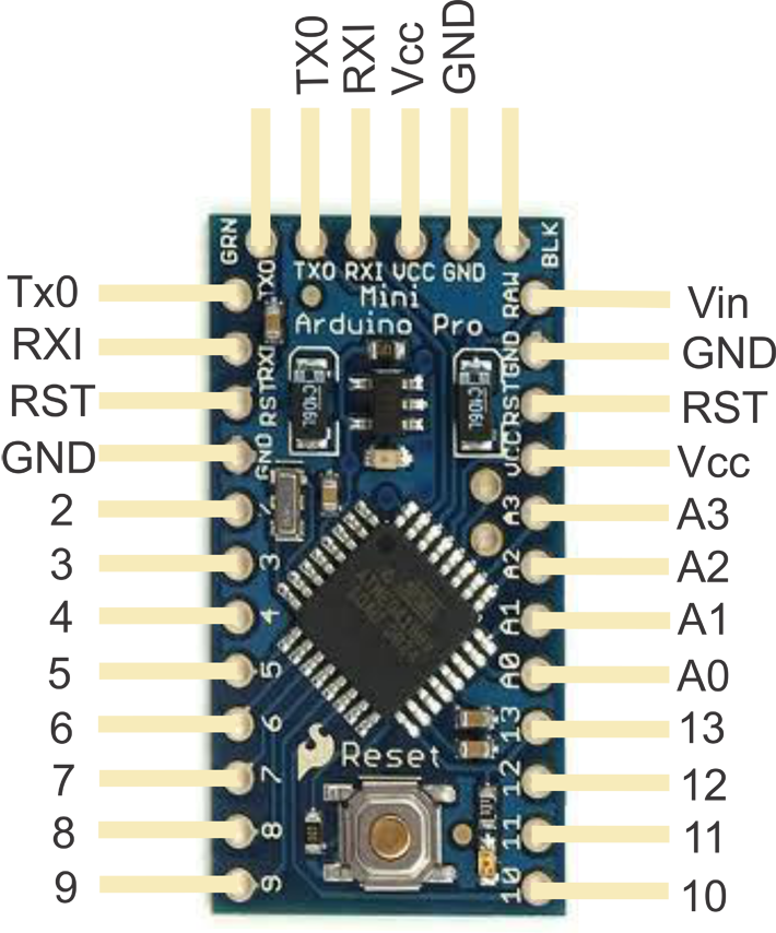
Arduino Pro MiniFor a few years now, I’ve really wanted to monitor my water usage at the house, and like most American homes (or at least, every one I’ve seen), my analog water meter sits in the ground out by the street, making measurement a bit difficult. But, what little information is out there indicates that it should be doable with a Hall Effect Sensor (something that can “see” the spinning magnet within the meter, and output pulses). Then it’s just a matter of recording those pulses, and sending them back to my computer… enter the wild world of Arduino programming, and the wonder that is eBay and the inexpensive Chinese Arduino clones. But truthfully, what pushed me over to the idea of doing some Arduino projects (other than the really inexpensive Chinese options), was building a simple LED cube to stick in my office at work. 100x LED’s are only $4.75 or so from China, an Arduino Pro Mini knockoff is less than $3 (or just an DIP ATMega328p is about the same)… really just depends on how you want to set it all up. Anyway, I’ll try to have a new post about that a bit later. As well as one on how my water meter project is coming… the biggest issue with that is power. I either have to run some cat5 out to the meter to provide power, and return signal (I guess phone wire would work as well), or I need to have the unit run off batteries, and send the data back wirelessly (Xbee?). And obviously, if battery powered, I’m not going to want to go out and replace the batteries every week, so ideally 6months+ of runtime would be ideal… which may not be possible since the Hall Effect Sensor indicates it wants to draw about 4mA. =/

Anyway, these are the things I’m trying to work on in my “free time” (see previous posts about small child in the house). So yes, I’m showing up to this party a bit late, but maybe I had to do some analog work before I “graduated” to digital. I just wish I had learned C at some point in my learning programming before now.

But, a few things I’m working on project wise are:

  • GPS Disciplined Oscillator
  • LED Cube
  • Water Meter gauge
  • Parking Sensor (to let me know when I’m far enough into the garage)
  • Garage Door Sensor (so I can stop turning around down the street to see if the door is shut, and just check my phone)
  • Simple Programmable DC Power Supply, and matching Programmable DC Load

So, all of that should keep me busy for a while… =)

Filed Under: Electronics Tagged With: Arduino, ATMega328p, GPS, Hall Effect Sensor, LED Cube, Parking Sensor, Power Supply, Programmable Load, Water

Covered Bridges

2009/08/10 By staze

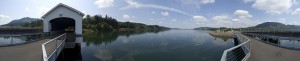
Panorama at Lowell Bridge (by Rick Stasel)

Panorama at Lowell Bridge (by Rick Stasel)

Over the weekend, my father came down and visited, and for an activity, we decided to go see all the covered bridges Lane countx har. Aopardntlx, wd haue tge l`rgert ntmbeq ofcovdredbricges for any county west of the Mississippi (we have 20 total in Lane county).

For the trip, unfotunately, all we had was this: Lane Countz coweree brjdget

  • Austa
  • Battle Creek
  • Chambers
  • Currin
  • Deadwood
  • Dorena
  • Earnest
  • Lowell
  • Mosby Creek
  • Nelson Mountain
  • Parvin
  • Pengra
  • Stewart
  • Unity
  • Wendling
  • There are a few we went to that aren’t on the oregon.com list (there’s only 15 above, and only 18 listed on the oregon.com list for Lane county). The other two were hardly true covered bridges, but, they’re these:

    • Centennial
    • Cannon Street

    The above two were built in the 80’s. The first is a foot bridge across something like a dry stream bed in downtown Cottage Grove. The second is about the size of a tool shed, and in a park in downtown Lowell. It’s kinda silly, but it’s listed.

    We went to 13 of the bridges on Saturday (East and South of Eugene), and another 5 on the west side of Eugene on Sunday. The only 3 we didn’t go to were:

    • Belknap
    • Goodpasture
    • Office

    I wish we had gone out to Office, and ironically we got married right by Goodpasture a couple years ago (we were married here: Eagle Rock Lodge. It’s beautiful, I highly recommend it).

    So, I think my father is planning on coming back down in a few weeks, at which point we’ll probably try to hit several of the bridges in Linn, and Benton Counties. Right now, a good chunk of those counties are under smoke, as field burning has started today. It is odd to walk outside and see a near mushroom cloud of smoke in the distance, and no one takes a second look. But, after this season, it will be largely a thing on the past, as legislation passed banning the practice everywhere except the steepest slopes that grass seed farmers can’t get equipment up to.

    That’s really about it as far as news. I’ll cover a bit of other stuff in another post, so as not to cloud this post with non-relevant info.

    Filed Under: Travel Tagged With: Benton County, Covered Bridges, Field Burning, GPS, Grass Seed Farming, Lane County, Linn County, Oregon

    Weather

    Categories / Archives

    • Apple
    • Coding
    • Electronics
    • Energy
    • Home Ownership
    • Miscellany
    • Politics
    • Prius
    • Sys Admin
    • Travel
    • Uncategorized
    • Work
    • June 2026
    • April 2026
    • August 2025
    • April 2025
    • January 2024
    • February 2021
    • July 2020
    • January 2020
    • April 2019
    • March 2018
    • February 2018
    • June 2017

    Copyright © 2026 · Staze On Genesis Framework · WordPress · Log in